Quick start#
Below is a short example show-casing some of the core functionalities of xDEM. To find an example about a specific functionality, jump directly to More examples.
Download data examples#
Example data from xDEM can be automatically downloaded with the function xdem.examples.get_path() as shown below.
See the Data examples page to learn more about all our example data and different download options.
Python example#
Note
xDEM relies largely on its sister-package GeoUtils for geospatial handling (reprojection, cropping, raster-vector interface, point interpolation) as well as numerics (NumPy interface). 🙂
xDEM revolves around the DEM class (a subclass of Raster) and the EPC class (a subclass of PointCloud), from
which most methods can be called. The Coreg class is used to build modular coregistration pipelines.
Below, in a few lines, we load two DEMs and a vector of glacier outlines, crop them to a common extent, align the DEMs using coregistration, estimate the elevation change, estimate elevation change error using stable terrain, and finally plot and save the result!
import xdem
import geoutils as gu

# Examples files: filenames of two DEMs and some glacier outlines
fn_dem_ref = xdem.examples.get_path("longyearbyen_ref_dem")
fn_dem_tba = xdem.examples.get_path("longyearbyen_tba_dem")
fn_glacier_outlines = xdem.examples.get_path("longyearbyen_glacier_outlines")

# Print filenames
print(f"DEM 1: {fn_dem_ref}, \nDEM 2: {fn_dem_tba}, \nOutlines: {fn_glacier_outlines}")
DEM 1: /home/docs/checkouts/readthedocs.org/user_builds/xdem/checkouts/latest/xdem/example_data/Longyearbyen/data/DEM_2009_ref.tif,
DEM 2: /home/docs/checkouts/readthedocs.org/user_builds/xdem/checkouts/latest/xdem/example_data/Longyearbyen/data/DEM_1990.tif,
Outlines: /home/docs/checkouts/readthedocs.org/user_builds/xdem/checkouts/latest/xdem/example_data/Longyearbyen/data/glacier_mask/CryoClim_GAO_SJ_1990.shp
Tip
Set up your Verbosity level to manage outputs to the console (or a file) during execution!
# Open files by instantiating DEM and Vector
# (DEMs are loaded lazily = only metadata but not array unless required)
dem_ref = xdem.DEM(fn_dem_ref)
dem_tba = xdem.DEM(fn_dem_tba)
vect_gla = gu.Vector(fn_glacier_outlines)
# Clip outlines to extent of reference DEM (method from GeoUtils)
vect_gla = vect_gla.crop(dem_ref, clip=True)
# Create a mask from glacier polygons (method from GeoUtils)
mask_gla = vect_gla.create_mask(dem_ref)
# We convert the vertical CRS of one DEM to the EGM96 geoid
dem_ref.to_vcrs("EGM96", force_source_vcrs="Ellipsoid")
# Align the two DEMs with a coregistration: 3D shift + 2nd-order 2D poly
mycoreg = xdem.coreg.NuthKaab() + xdem.coreg.Deramp(poly_order=2)
mycoreg.fit(dem_ref, dem_tba, inlier_mask=~mask_gla)
dem_aligned = mycoreg.apply(dem_tba)
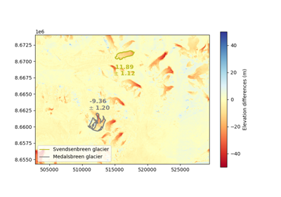
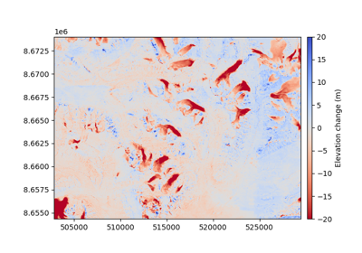
# Get elevation difference
dh = dem_ref - dem_aligned
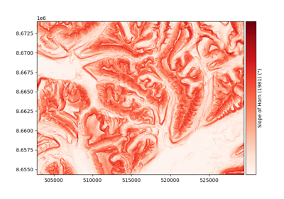
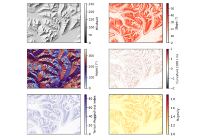
# Derive slope and curvature attributes
slope, max_curvature = xdem.terrain.get_terrain_attribute(
dem_ref, attribute=["slope", "max_curvature"]
)
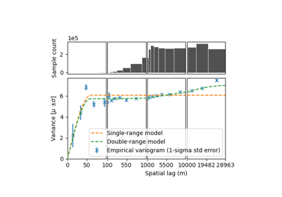
# Estimate elevation change error from stable terrain as a function of slope and curvature
dh_err = xdem.spatialstats.infer_heteroscedasticity_from_stable(
dh, list_var=[slope, max_curvature], unstable_mask=mask_gla
)[0]
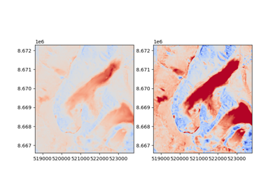
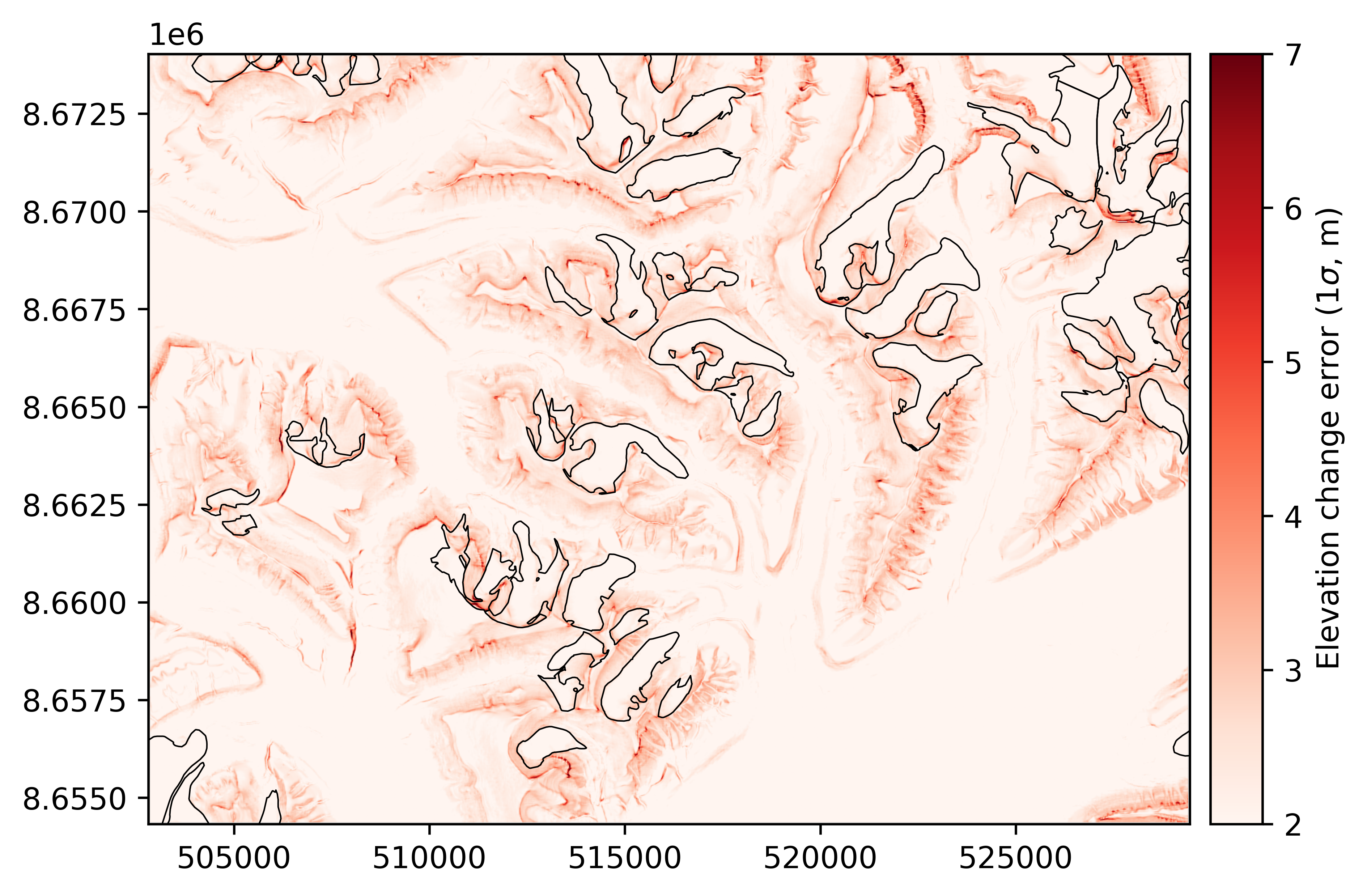
# Plot dh, glacier outlines and its error map
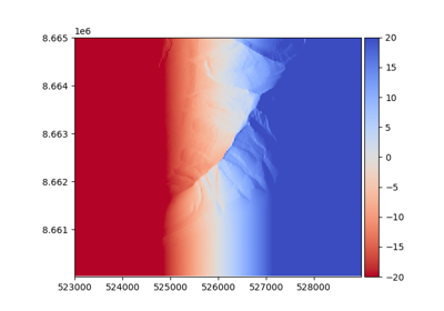
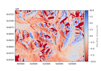
dh.plot(cmap="RdYlBu", cbar_title="Elevation change (m)")
vect_gla.plot(dh, fc='none', ec='k', lw=0.5)
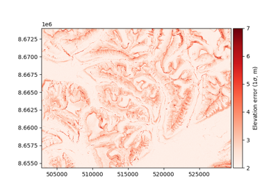
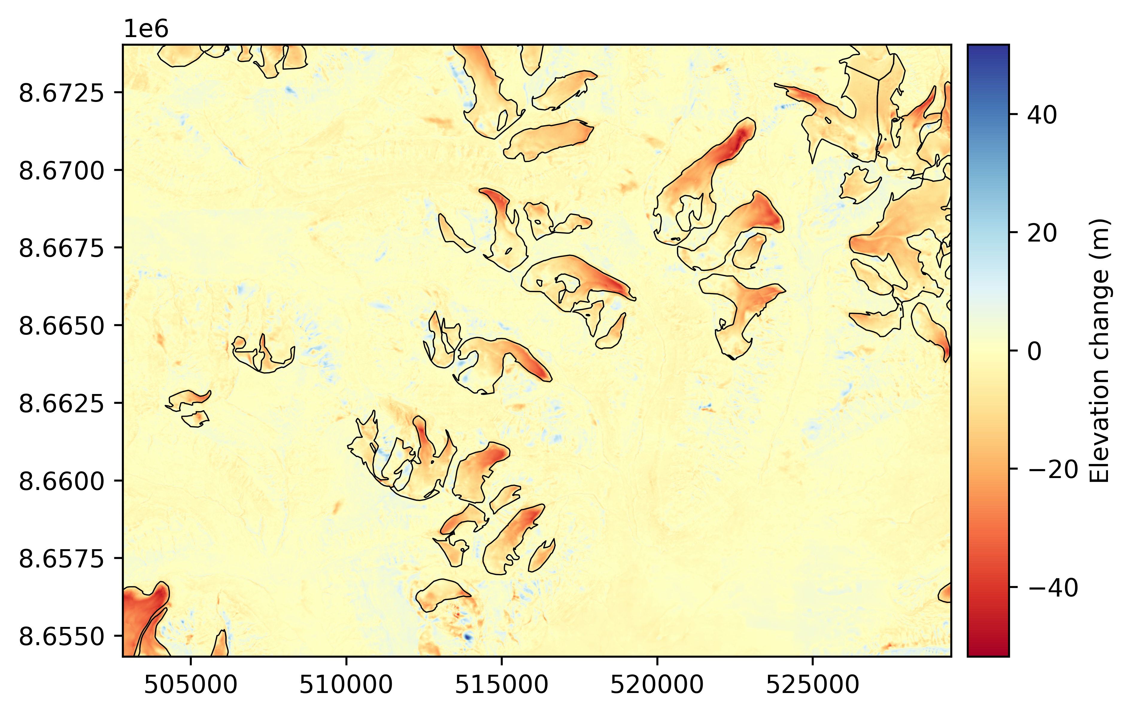
dh_err.plot(ax="new", vmin=2, vmax=7, cmap="Reds", cbar_title=r"Elevation change error (1$\sigma$, m)")
vect_gla.plot(dh_err, fc='none', ec='k', lw=0.5)
# Save to file
dh_err.to_file("dh_error.tif")
Command-line example#
xDEM also support several workflows (series of analysis steps) through a command line interface, such as the accuracy and topo workflows to perform an accuracy assessment or generate a topographical summary of your elevation data, respectively. These workflows use inputs on disk (elevation data files and a YAML configuration file), and generate outputs on disk (plots, tables, and HTML/PDF report).
Caution
The command-line interface for workflows is experimental, and its API might change rapidly.
The configuration file should contain, at minima, the path to elevation files but aims to be modular to tune the use of xDEM’s features (see details in the Command line interface reference page). Here is an example of configuration file for the accuracy workflow:
inputs:
  reference_elev:
    path_to_elev: "../../../xdem/example_data/Longyearbyen/data/DEM_2009_ref.tif"
  to_be_aligned_elev:
    path_to_elev: "../../../xdem/example_data/Longyearbyen/data/DEM_1990.tif"
    path_to_mask: "../../../xdem/example_data/Longyearbyen/data/glacier_mask/CryoClim_GAO_SJ_1990.shp"
outputs:
  path: "outputs_accuracy"
coregistration:
  step_one:
    method: "LZD"
    extra_information: {"subsample": 10000}
statistics:
- median
- nmad
- validcount
Then, run the workflow using:
xdem accuracy --config config_file.yaml
The outputs are written by default in an outputs folder of the current directory.
More examples#
To dive into more illustrated code, explore our gallery of examples that is composed of:
A Basic section on simpler routines (terrain attributes, pre-defined coregistration and uncertainty pipelines),
An Advanced section using advanced pipelines (for in-depth coregistration and uncertainty analysis).
See also the concatenated list of examples below.