Note
Go to the end to download the full example code
Terrain attributes#
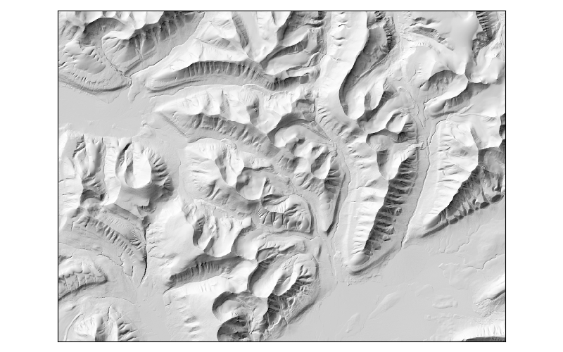
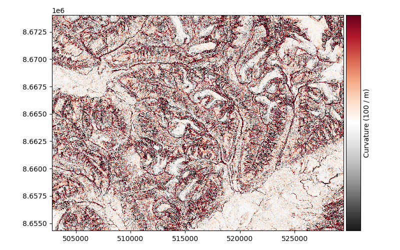
Terrain attributes generated from a DEM have a multitude of uses for analytic and visual purposes. Here is an example of how to generate these products.
For more information, see the Terrain attributes chapter and the Slope and aspect methods example.
import matplotlib.pyplot as plt

import xdem
Example data
dem = xdem.DEM(xdem.examples.get_path("longyearbyen_ref_dem"))


def plot_attribute(attribute, cmap, label=None, vlim=None):

    add_cbar = True if label is not None else False

    fig = plt.figure(figsize=(8, 5))
    ax = fig.add_subplot(111)

    if vlim is not None:
        if isinstance(vlim, (int, float)):
            vlims = {"vmin": -vlim, "vmax": vlim}
        elif len(vlim) == 2:
            vlims = {"vmin": vlim[0], "vmax": vlim[1]}
    else:
        vlims = {}

    attribute.plot(ax=ax, cmap=cmap, add_cbar=add_cbar, cbar_title=label, **vlims)

    plt.xticks([])
    plt.yticks([])
    plt.tight_layout()

    plt.show()
Slope#
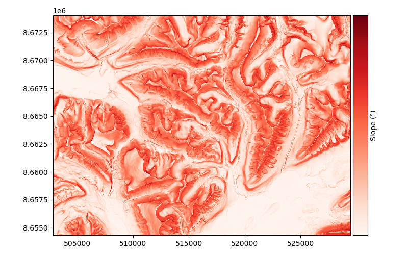
Note that all functions also work with numpy array as inputs, if resolution is specified
Aspect#
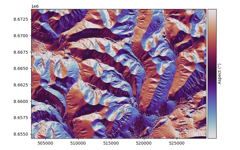
Hillshade#
Curvature#
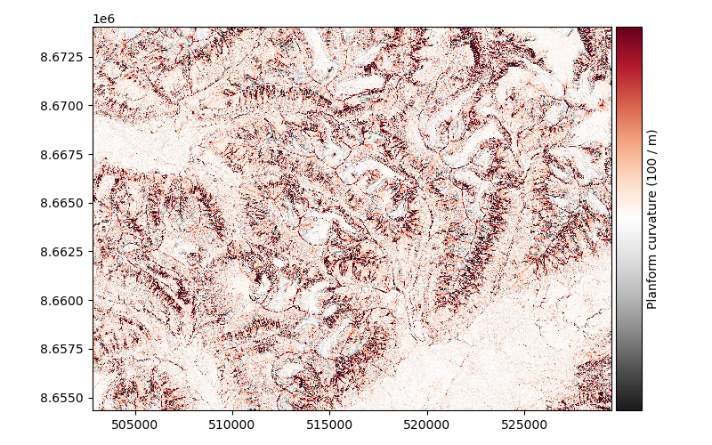
Planform curvature#
planform_curvature = xdem.terrain.planform_curvature(dem)

plot_attribute(planform_curvature, "RdGy_r", "Planform curvature (100 / m)", vlim=1)
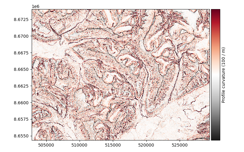
Profile curvature#
profile_curvature = xdem.terrain.profile_curvature(dem)

plot_attribute(profile_curvature, "RdGy_r", "Profile curvature (100 / m)", vlim=1)
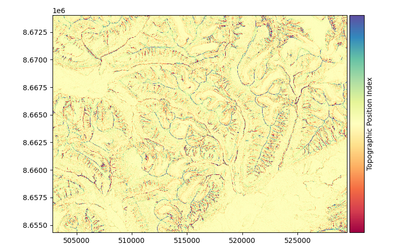
Topographic Position Index#
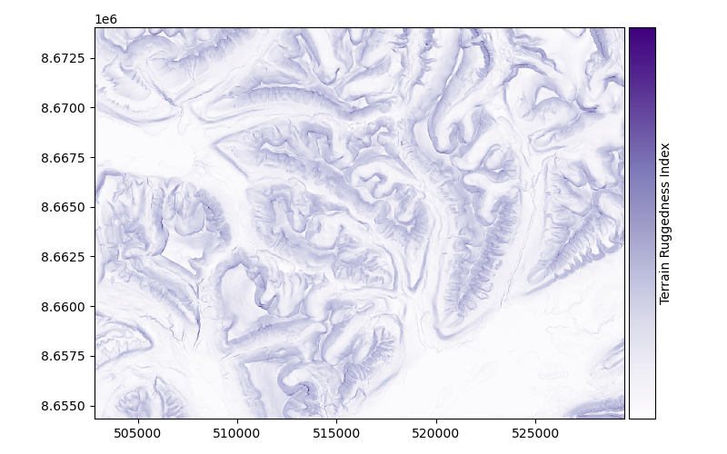
Terrain Ruggedness Index#
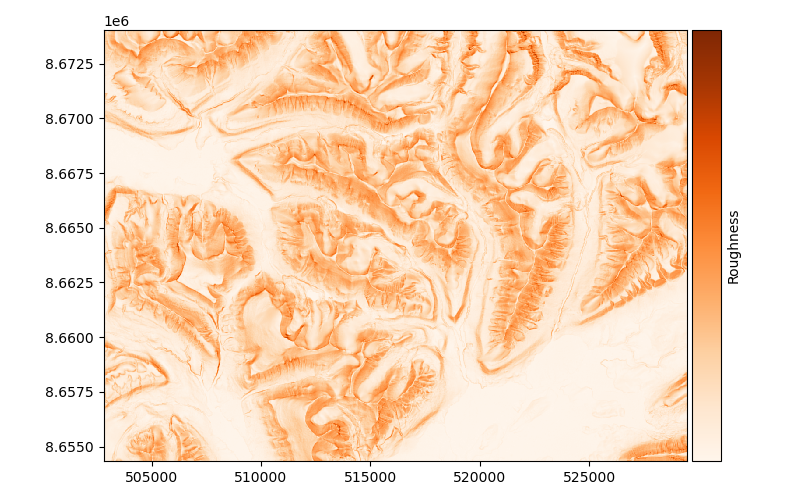
Roughness#
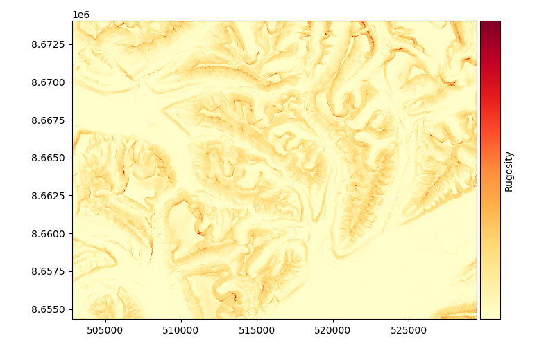
Rugosity#
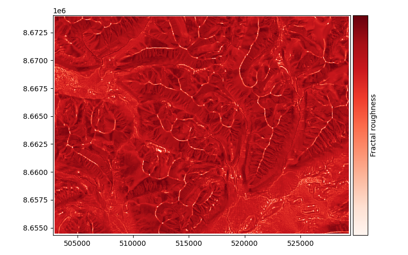
Fractal roughness#
fractal_roughness = xdem.terrain.fractal_roughness(dem)

plot_attribute(fractal_roughness, "Reds", "Fractal roughness")
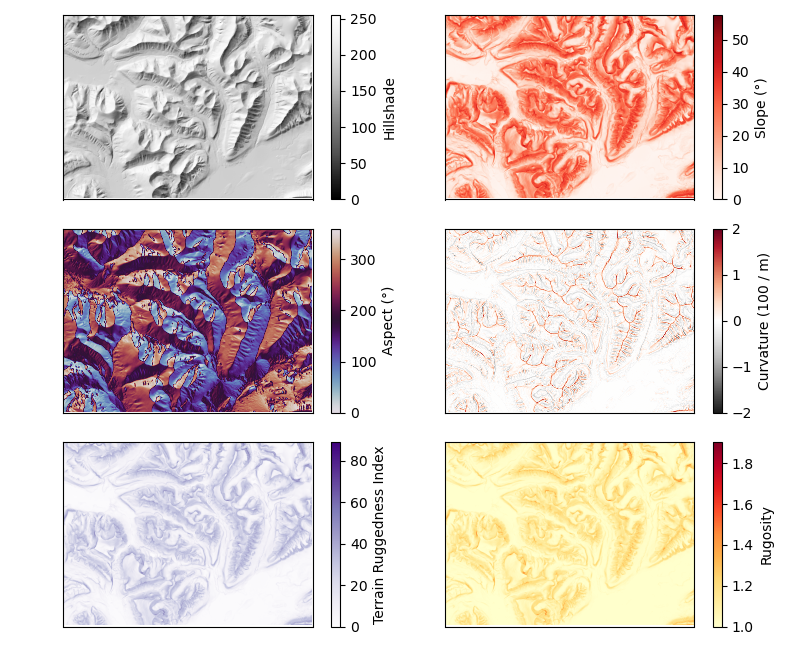
Generating multiple attributes at once#
attributes = xdem.terrain.get_terrain_attribute(
    dem.data,
    resolution=dem.res,
    attribute=["hillshade", "slope", "aspect", "curvature", "terrain_ruggedness_index", "rugosity"],
)

plt.figure(figsize=(8, 6.5))

plt_extent = [dem.bounds.left, dem.bounds.right, dem.bounds.bottom, dem.bounds.top]

cmaps = ["Greys_r", "Reds", "twilight", "RdGy_r", "Purples", "YlOrRd"]
labels = ["Hillshade", "Slope (°)", "Aspect (°)", "Curvature (100 / m)", "Terrain Ruggedness Index", "Rugosity"]
vlims = [(None, None) for i in range(6)]
vlims[3] = [-2, 2]

for i in range(6):
    plt.subplot(3, 2, i + 1)
    plt.imshow(attributes[i].squeeze(), cmap=cmaps[i], extent=plt_extent, vmin=vlims[i][0], vmax=vlims[i][1])
    cbar = plt.colorbar()
    cbar.set_label(labels[i])
    plt.xticks([])
    plt.yticks([])

plt.tight_layout()
plt.show()
Total running time of the script: (0 minutes 49.865 seconds)